Photography, Travel

Picture Perfect Breakfast in Montana

If there’s anything I love more than breakfast food, it’s my friend Kate’s pictures of breakfast food.

In her reluctant hometown of Helena, Montana, Kate has captured some of the most delectable pictures of dark diners I have ever encountered. For years I have lusted over her beautiful photographs — which you can find on her blog Ze Photographist —  but it wasn’t until this summer’s road trip that I was finally able to experience her favorite haunts first hand.

Behold, No Sweat Cafe, with its handwritten menus, motown music and strict “no cell phones allowed” policy

DSC_1196

DSC_1197

This breakfast table was crowded with multiple cameras and good friends.

DSC_1198

DSC_1202

The most picturesque buttered toast I have ever seen.

DSC_1204

DSC_1206

DSC_1207

Walking away from the cafe, Kate pointed out downtown Helena’s restored brick wall advertisements and the spot where the used bookstore leaves free romance novels out on the street.

DSC_1211

DSC_1212


Advertisement
Standard
Photography, Travel

Road Trip Travelogue Day 5: Last Day in Yellowstone

Once Philip and I found the best campsite in Yellowstone (see Day 4), it was hard to face that we would have to leave the park.

Here are some photos from our last full day, which we spent hiking and fishing. We had no luck with the fish, but we did spot a buck and wrangled a small snake!

DSC_1062.jpg

DSC_1070.jpg

DSC_1074.jpg

DSC_1077.jpg

DSC_1083.jpg

DSC_1091

DSC_1092

DSC_1093

DSC_1096

DSC_1102

DSC_1104

DSC_1105

DSC_1109

DSC_1113

DSC_1117

DSC_1123

DSC_1133

Read my other Road Trip Travelogues here:

Day 4

Day 3

Day 2

Day 1


Standard
Photography, Travel

Road Trip Travelogue Day 4: The Best Campsite in Yellowstone

Finding an available camping spot in a National Park during peak season may seem impossible, but Philip and I proved through experience that you can get one of *the most beautiful* campsites in Yellowstone, even when you fly by the seat of your pants. I would say third time’s the charm, but in our case it was our fourth night in the park that we found campsite W6 at the Norris campground.

DSC_1067.jpg

After days of finagling last minute reservations with confused concessioner campground staffers, we finally decided to give the first-come-first-serve campsites run by the National Park Service a go.

We woke up early, drove to Norris, parked in a line of cars and waited in front of the camp office. Even though we were sixth in line, the wait was long. It turned out to be well worth it when the woman helping us beamed and said, “Can I offer you the most beautiful campsite in all of Yellowstone?” Walking out to our site, we could see exactly what she meant: a winding river and open meadow invited us to set up camp and enjoy the scenery. Perched on the edge of the campground we felt like we had the meadow to ourselves. The sounds of the river and singing birds overtook the chatter of nearby campers. I was so happy, I changed into my “cute camping” outfit to celebrate.

The day’s first order of business was paying Ol’ Faithful a visit. I didn’t take any pictures of that geyser but I did document some of the other geysers we saw.

DSC_0956

DSC_0959

Chromatophores or colorful bacteria give this hot spot its vivid colors.

DSC_0965

I ate a tiny pizza, this seemed noteworthy.

DSC_0966

When we returned to camp, Philip decided to go fish along the winding Gibbon River. I went out with my camera to capture the last bit of daylight. Even the scary bear signs looked more picturesque at this campsite.

DSC_0984

The camp office looking very much like a cozy cabin.

DSC_0987

A peek at the Gibbon River.

DSC_0989

The meadow catching the last bit of light. I think it was nearly 10 PM at that point.

DSC_0999

DSC_1009

The view from W6.


DSC_1031

DSC_1039

Thank you Yellowstone Firewood!

DSC_1061 (1)

Philip’s hat on our campsite picnic table.

DSC_1050

Read my other Road Trip Travelogues here:

Day 3

Day 2

Day 1


Standard
Photography, Travel

Road Trip Travelogue Day 3: Reunion at Lost Lake

After saying an abrupt goodbye to my college friend Kate in our second year at Franklin College Switzerland (now University), I wish someone could have told me that I would be reunited with her in Yellowstone 5 years later! It wouldn’t have softened the blow of her absence, but it would have given me something to look forward to, aside from her amazing blog post updates.

Kate’s stories about her home in Montana had always captured my imagination, and I knew I wanted to visit her there long before I made the trip a reality this summer. But before Montana, there was this little pit stop Philip and I wanted to make at a place called Yellowstone. So Kate and Logan, her gentleman caller, obliged us by meeting us for night of camping and a day of hiking in Wyoming!

After a night of catching up over s’mores and Montana brews, we ventured into the Northern reaches of the park. We stopped by Tower Roosevelt for a peek at the falls and some incredible basalt formations. Then we went on to hike the Lost Lake trail. Our first inclination was to hike towards a waterfall. When the trail petered out, we doubled back to find the Lost Lake, but not before catching sight of the fall we sought.

DSC_0934

Kate took photographs on this hike as well, which you can find on her blog Zephotographist under “Foxes, Frogs, and Hiking: A Day in Yellowstone.” I think it’s really interesting to compare the different subjects we chose to photograph on the same hike! She’s much better at taking photographs of people!

DSC_0938

DSC_0939

DSC_0940

DSC_0941

DSC_0942

DSC_0947

DSC_0952

After Kate and Logan left, Philip and I continued on to Mammoth to see the hot springs. We stopped to eat ice cream on a patch of grass not occupied by lounging elk.

DSC_0954

We also ate some pretty disappointing food in a cafeteria. Luckily, these old pictures of tourists in Yellowstone hanging on the walls more than made up for the bland meal.

IMG_1495

IMG_1498

After a long day of driving around the park and spotting wildlife (a mamma black bear and her two cubs!) along the roadside, we settled into yet another new campsite. I found this little face on a log and it made me smile.

IMG_1499

IMG_1507 (1)

It was a great day.

Standard
Photography, Travel

Road Trip Travelogue Day 2: The Grand Canyon of the Yellowstone

After driving into Yellowstone park in the middle of the night and cuddling my bear spray all night long, I had no idea what to expect upon waking up. I know it definitely wasn’t Philip telling me we had to move our tent because the campsite we had snuck onto was reserved for the day.

Luckily, the nice folk who worked at the Madison campground were able to find us another reservation at the Bridge Bay campground. After setting up our tent and making breakfast, Philip and I set out to take in the park. Driving past Yellowstone Lake, it was hard to believe that what we were seeing was real.

IMG_1422

IMG_1423

And it didn’t become any more real after we saw our first bison. They may look like lumbering creatures, but the alacrity with which they crossed this river, proved just how swift they really can be.


DSC_0758

DSC_0763

There is nowhere else I have experienced such wide open expanses. What struck me most about Yellowstone was the grand scale of this wide open nature. You really did feel closer to the clouds at this elevation.

DSC_0789

DSC_0798

DSC_0806

Our first hike was a loop through the back country starting by Artist Point at the rim of the Grand Canyon of the Yellowstone, where there are beautiful views of the falls.

DSC_0821

In the back country they tell you to hike in groups of 3 or more, make noise and carry bear spray. Thinking about all of this while walking a trail close to the edge of canyon made me a little nervous, but the views were worth it.

Luckily, there was a loud prepubescent boy walking on the same trail with his family, so all that made me nervous was watching him walk too far out onto the cliff’s edge.

After noticing trees with scratched and worn away bark, I began to realize that Yellowstone may be the first place I have ever been to that has been shaped just as much by wildlife as it has been by humans.

If you look closely, you may seem some hairs sticking to these claw marks. Philip and I assumed at the time that it must have been grizzly bear hair, but it could have been brown bear or even another animal altogether. I like to think it was grizzly though.

DSC_0830

DSC_0827

DSC_0842

Later, we would learn from my friend Kate that the larger markings were most likely created by a horned animal like a bison or male elk.

We also saw some tracks! A Google search leads me to believe that these are Bison tracks, feel free to correct me in the comments!

DSC_0919

As we followed our trail loop away from the canyon we entered a wooded area towards Clear Lake. And of course I had to stop to take some pictures of the wild flowers.

DSC_0916

DSC_0918

It was pretty marshy where we were headed.

DSC_0863

DSC_0878

DSC_0876

We could see the natural gases bubbling underwater. And when we arrived at Clear Lake, the water was a vivid turquoise blue caused by chromatophore bacteria.

DSC_0913

DSC_0912

I really liked the driftwood on the beach of this small lake. Philip and I sat for a minute on one of these logs but were driven away by the pungent sulphur smell.

Shortly after, the landscape changed completely and we walked along an ashy white plane with very little growing. We walked past this hole in the ground and listened to what sounded like boiling mud. We tried recording the sound but it was too hard to capture the fullness of each plop.

DSC_0904

Overall, it was an amazing first day in Yellowstone National Park!

DSC_0920

Standard
Photography, Travel

Road Trip Travelogue Day 1: 5 States

CA > NV > ID > MT > WY

5 States – 1 Day

Destination: Yellowstone National Park

Breakfast: scrambled eggs & homestyle potatoes

Departure: 5:30 something AM

First Stop: Black Bear Diner in Fernley, Nevada

DSC_0631.jpg

Unplanned Stop: adjacent casino in Fernley, Nevada

Philip’s Winnings: $12

Number of Photos I Took in the Casino Before Being Told Photography Was Not Allowed: 6

The Best Photograph of Those 6:

DSC_0646.jpg

Places to Pee in Nevada: Casinos

Places to Order Starbucks in Nevada: Casinos

Places to Lose Your Hope for Humanity in Nevada: Casinos

Where We Did Not Stop for Gas in Nevada:

DSC_0654

DSC_0670

DSC_0666

The RV Model’s Name: “Honey”

How I Fought Boredom While Driving Through Nevada: eating sunflower seeds and spitting the shells into a paper cup tucked into my seat belt

Number of Prisons We Passed in Nevada: 3

Number of Hitchhikers Allowed to Pick Up: 0

How Many Snakes We Stopped for in Idaho: 2

DSC_0719

My Impression of Idaho:

DSC_0718.jpg

Where We Ordered French Fries in Burley, Idaho: MacDonald’s, Burger King, Jack in the Box

DSC_0743.jpg

MacDonald’s: salty, greasy, too crunchy

Burger King: delicious when hot, too potatoe-y

Jack in the Box: perfect amount of salt and grease, good when cold

Winner: Jack in the Box

DSC_0745.jpg

Camping Advice from a Walmart Employee in Chubbuck, Idaho: “Keep the fire going all night… Do you have a gun?”

Camping Reservations Made: 0

Arrival Time in Montana: 12:30 something AM

Number of Grizzly Bear Warning Signs at Lonesome Hurst Campground in Montana: 3

How Long it Took to Decide to Keep Driving After 18 Hours on the Road: split second

Arrival Time in Yellowstone National Park: 1:00 AM

When We Snagged an Empty Camp Site at Madison Campgrounds: 1:30 something AM

When We Learned We Would Need to Move Our Tent: 8:30 something AM

Follow my blog here on adrienneblaine.com for more posts about my 10 Day Road Trip!

Standard
KQED

Read My First Article for Bay Area Bites!

Bay Area Bites is a food blog for Northern California’s Public Media KQED. My first article for Bay Area Bites was published today, and you can read it here! The article is titled: “Pie Ranch Sells Food for Thought at Highway One Non-Profit Farm Stand.”

I first came across Pie Ranch while driving from San Francisco to Santa Cruz along Highway One. It was the first time I had taken the coast for this commute and was enjoying the wonderfully scenic drive. As I neared Santa Cruz, I noticed hand-painted signs for pie & coffee cropping up. There is no one who loves pie and coffee more than I do, so I felt compelled to stop and investigate these claims. I pulled into Pie Ranch and wandered into their farm stand.

DSC_9385 (1).jpg

Can you spot the hummingbird in this picture?

Something about the late afternoon light and the surprise of this quaint roadside offering really captured my imagination. Once inside I was impressed by sumptuous produce and socially conscious offerings. I have been able to visit multiple times and have learned more about the farm with each visit.

If you live in the California Bay Area, or plan to pass through during a road trip on Highway One, you’ll want to check out my article to learn about what Pie Ranch has to offer. Their next family-friendly event is happening this Saturday, April 16!

Standard
Travel

Waiting to Be Born in Death Valley

“One day, in the Time When Animals Were People, Coyote came to the valley. The people were small then, so Coyote kept them in a large basket he carried on his back. After a long journey, Coyote grew tired. When he came to a place at the north end of the valley, he set his burden down on the earth. The moment he fell asleep, the people climbed up out of the basket and ran away in all directions. The place where they emerged is called Ubehebe Crater today, and it’s hollow like the shape of a wosa, or basket. After Coyote woke up, he walked up and down the valley naming the places where the people could live. That’s how the Timbisha knew where to find everything they needed.”

This excerpt from Indian Country, God’s Country: Native Americans And The National Parks by Philip Burnham retells the Timbisha Shoshone story of how the indigenous people came to find their home in what we call Death Valley. Burnham’s writing explores the fraught relationships between Native Americans and national parks. He goes on to explain that pioneers came through the same valley and saw it not as a gift but as a death sentence. Their hostile relationship to the land was reflected in the name Death Valley.

Standing above Ubehebe or “Tem-pin-tta- Wo’sah,” (Coyote’s Basket), I was surprised that I was not made uneasy by the site’s explosive origins. The crater was formed by what is called a maar volcano, where magma bubbles up to the earth’s surface, heating the ground water and causing an explosion that leaves a crater behind.

I can understand why this crater would seem like a great place for a heavy basket filled with humankind. There was something welcoming and comforting about the spot. Although we were not carried by a coyote, I did feel like Philip and I were carried to the crater by a certain force. An interesting encounter we had with a raven just moments before entering the crater intensified this feeling.

While eating yet another peanut butter and jelly sandwich, Philip and I sat facing away from the crater. We watched better equipped cars make their way on unpaved roads to a site we were going to have to wait to see: the Racetrack.

Both of us were having a hard time finishing our dry sandwiches in the dry weather. Philip dejectedly showed me two pieces of crust he couldn’t bring himself to eat. I pointed to a raven in the distance, which prompted Philip to throw his scraps out as an offering. The raven quickly flew over to where Philip had thrown the crusts.

After eating the first scrap it jumped up and flapped its wings before taking the next scrap in its beak. We were surprised when it started walking deliberately towards us, while holding the second piece of bread in its mouth. With its head cocked to the side, it was giving us, and particularly Philip, an assessing look. We were close enough to see the raven blink several times as it came closer: a black marble never disappearing, just briefly covered in a gray film.

It almost seemed to be asking us whether we had really intended to give it this food. Or maybe it was trying to gauge our intentions. Who knows what kind of discriminations Ravens have endured? I have heard that Ravens are capable of memorizing people’s faces. When it finally flew away, I whispered to Philip, “the ravens know your face now.”

Watching the raven fly into the crater, we felt we had been given a cue to get moving. Here are some pictures of Philip as we walked into the crater. You can see how steep the descent was, and how much smaller the people already in the crater appeared in the distance.

After hiking (read: sliding) down into the crater, we were met with a stillness that did not exist at the top, where the wind whipped aggressively. Nestled in the valley of the crater, it really did feel like we were in some sort of cradle. Looking up, we could see that our raven had a friend and a nest in the crater. It had probably brought the second piece of bread to share with its mate.

Once at the bottom we were the only ones there. We laid down on the cracked mud and basked in the sun. Feeling restored after our nap, we got up and prepared ourselves to climb out of the Coyote’s Basket.

At some parts it felt more like crawling, but there were beautiful purple and yellow flowers lining the path. There’s no better feeling than pulling yourself up to a great height. Climbing out of the crater felt like a huge accomplishment.

We returned to our campsite for our last night. We watched the sunset and the fighter jets and drank instant coffee out of scalding enamelware.

The next day we packed up camp and made one last stop at Zabriskie’s Point before driving the eight hours home.

Another El Niño storm was rolling, held back from the valley by the rain shadow created by surrounding mountains. As we drove through the changing weather, a lyric from one of Philip’s favorite songs by John K. Samson (“Heart of the Continent“) resonated:

“Inky bruises are punched into the sky by bolts of light and then leak across the body of tonight, while rain and thunder drop and roll, then stop short of a storm, leave the air stuck with this waiting to be born.”

I overheard a man say that all the flowers we saw in Death Valley were the result of one storm on the night of October, 18 2015: thunder, lightning and flash floods. The seeds of life patiently wait for their time, but when given the opportunity, they climb out of Coyote’s Basket and spread through the Valley.

This trip to Death Valley was the perfect way to celebrate turning 25 years old. I cannot recommend trips to national parks enough. I look forward to finishing Burnham’s book to learn more about how national parks can better serve the native people who knew the land before conservation efforts became necessary. Why should we value people any less than landmarks?

Standard
Travel

Dorky Hats in Death Valley

There’s nothing like waking up to the sound of fighter jets breaking the sound barrier when you can’t remember where you are. After driving all night to arrive in Death Valley for the sunrise, we had set up camp and slept for five hours. Meanwhile, our yellow tent had become an Easy-Bake Oven in the desert high noon.

Turns out those UFO’s Philip and I were keeping an eye out for the night before probably would have been pilots from nearby Mojave military base. Or at least, that’s what they would have wanted us to think ;-P

We were lured out of our cave by the promise of cooler air outside. It didn’t get hotter than 90 degrees Fahrenheit during our trip, which is quite pleasant for Death Valley, but Philip and I both have icy Scandinavian blood running through our veins.

After slapping some sourdough PB & J’s together, dousing ourselves in sunscreen, and donning our hats, we felt fortified enough to begin exploring the park. You can’t go to Death Valley without stopping at the lowest point in North America: Badwater Basin. But we made a few stops along the way.

We took a quick look at the remnants of an old Borax refinery. The most important thing I took away from our tour was that Borax cannot crystallize at temperatures above 120 degrees Fahrenheit. So this refinery could not operate during the summer. That’s right, Death Valley consistently gets hotter than 120 degrees Fahrenheit in the summer.

Our camp neighbor had suggested we stop at the Devil’s golf course. He told us that it didn’t look like much from the road, but once you got out to the fields of crystallized salt, it was the closest thing to another planet as he had ever seen.

He was right, the turn would have been easy to overlook, but with his recommendation in mind, we decided to take the detour. Much like the lava fields of Iceland, “moon like” is the descriptor that comes to mind when looking out over these jagged landscapes.

The sign post warns explorers to climb the salt formations with care as any fall could result in broken bones. Emerging unscathed, we were off to Badwater.

282 feet below sea level becomes much more real when you look up a cliff face and see a tiny sign marking sea level. I have lived near the ocean for most of my life. Even when I studied in Switzerland for four years, I was still living at sea level in a valley surrounded by alps.

I had to chew gum as we drove through the park just to encourage my ears to pop with all the elevation changes we were making. Thankfully, my ears finally equalized by the time we arrived at the basin.

Badwater is another one of those names that gives Death Valley an edgy feel. Just as Death Valley is actually full of life, it turns out the water in the basin isn’t poisonous, just really salty. “Notgreatwater Basin” doesn’t have the same ring to it though.

After peering in the pools of murky water, we walked out as far as we could along the beaming white salt flats. Our goal was to make it further than the other tourists, although we were not willing to go as far as some other dedicated photographers on the horizon.

Once back in the car we decided to pull off onto Artist’s Drive. Before taking a loop through the park’s colorful mountains, we stopped at a view called the Artist’s Palette. This is where we snapped our dorky hat selfie. There were also some beautiful flowers growing in an around this area.

While touring Artist’s Drive I remembered Grizzly Bear’s music video for their song, “Knife.” I now realize it was filmed in Death Valley (possibly by Zabriskie Point?) and clearly inspired by the desert refineries of the 19th and 20th Centuries.

This song is from one of my favorite albums, Yellow House, and I was pleased to find that the rest of the songs perfectly suited the desert landscape. If you ever need a good desert road trip playlist, I recommend including songs by Grizzly Bear, Nick Drake and Jose Gonzalez.

Death Valley is set up to accommodate tourists who want to stay in their cars. With the risk of heat stroke so high, this makes sense to me. Philip and I only wish we had come in a car with tires suited for off-roading or at the very least, one with a full-sized spare so we could get to more remote sights like the Racetrack and Eureka Dunes.

We were surprised by some bold compact cars speeding on unpaved roads. We took it nice and easy and kept an eye out for the numerous road signs warning about road conditions. Rangers warn that the highest number of park fatalities come from single car rollovers.

For sunset, we found a nice spot on the Mesquite Dunes. The sand on these dunes was unbelievably fine and soft. In Death Valley, you are especially aware that this sand is the result of millions of years of erosion. Alluvial fans of eroded rock spill off the surrounding mountains, continually filling up the valley even as it sinks with every tectonic shift.

Even among the extremes of desert life, there’s a strong sense of equilibrium in Death Valley. Being able to see the effect of time on even the most indomitable landscape reminds you that nothing is permanent.

As we laid in the sand and watched clouds drift past, we made plans to get out of the car and experience more of the landscape on foot the next day.

To read more about our Death Valley adventures, stay tuned for more blog posts and read:

No Sleep ‘Till Death Valley

Death Valley Birthday

Standard
Travel

No Sleep ‘Till Death Valley

Driving eight hours through the night to be in Death Valley at sunrise on my birthday was a decision Philip and I made without hesitation.

By the time Philip was ready to hand off driving to me at about 4 am, we had entered into the kind of landscape you would associate with a road trip through the desert. A two lane road with an ever-stretching yellow line pulled us forward over dips and through sharp turns.

With the moon nowhere to be found, we could only see as far as the headlights on Philip’s car (named Clyde) could reach. In our delirious state, we could have been on another planet for all we knew.

The only thing bringing us back to reality was the local Spanish language radio station 95.1 — the lone frequency emerging from comprehensive static. Its Mexican polka music was the best soundtrack for our excitement and confusion.

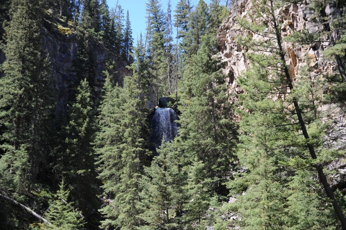
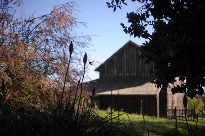
At night, the refineries and factories of Trona were lit up like golden honeycombs. As we left this small industrial community and started winding through craggy rocks, Philip insisted we pull over to take a look around.

The way the cold air whipped around us, we could tell we were standing on a ledge overlooking a valley. Just how far down, we couldn’t tell. The feeling of being exposed was overwhelming.

Despite how much I would have loved to stay and look up at more stars than I had ever seen in my life, my instinct to seek shelter was stronger. I rushed back into the car and turned my seat warmer on.

During our return trip in daylight I would discover that a somber cross marked the same spot we had pulled off on the road. My sense of foreboding was not merely in my imagination.

Not long after, we encountered road construction and signs indicating “end paved road.” Following a zippy Camry, we were not so brave on this washboard, taking it below 5 miles per hour at times.

We had no idea how long the road, or lack thereof, would continue. So we bumped along for what seemed like hours. Even when we were back on paved road, space and time did not make any more sense.

We would think we were following the tail lights of a car in front of us, when it would turn out to be an approaching road sign. Surreal lights in the distance beckoned from unexpected angles and made us feel like we were driving in circles.

Philip and I tried not to think about the X-Files for the first time in our relationship.

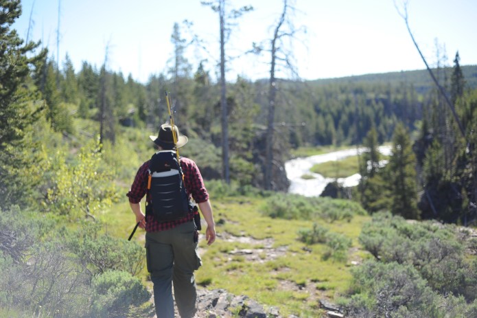
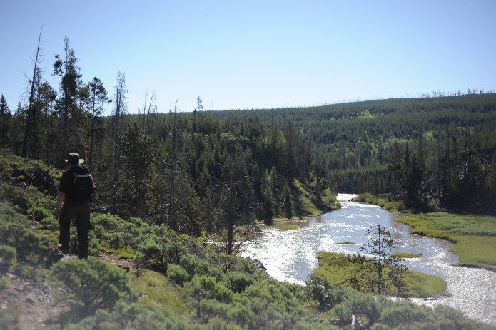
As we pulled into Death Valley and past the Stove Pipe Wells camping ground, it was a relief to know we were around people once more, but there was not time to stop as we raced the sunrise.

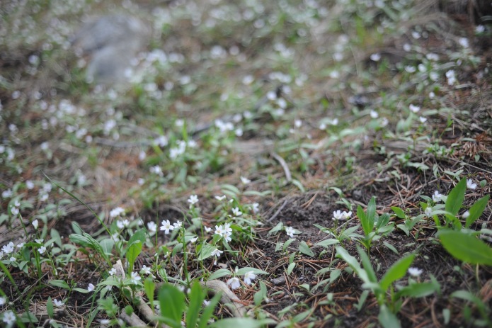
Our goal was to find a patch of flowers to sit in as we watched the sun come up. The only problem was that we still couldn’t see what the landscape around us had in store. As flowers started popping up in Clyde’s headlights along the side of the road, we cheered.

We hadn’t wanted to acknowledge the possibility that the flowers could’ve been gone by the time we arrived, but now that we saw them, we could justify the arduous trip.

Keeping in mind reports of where flowers had been sighted in lower elevations, we kept going blindly into the valley until we thought we had found a decent patch. I got out and began taking blurry pictures of a flower on the roadside.

I was so absorbed in this task that I took me a moment to respond to Philip’s whistle. Looking behind me, I saw a hillside covered in yellow flowers, waving to us in the breeze: without knowing it, we had hit the jackpot!

To come so far and be rewarded with such a show of flowers was incredible.

The yellow flowers dotting this hill are known as “Desert Gold” or Geraea canescens, but closer inspection revealed a range of other beautiful species. Purple Caltha-Leaf Phacelia (Phacelia calthifolia) and Purplemat (Nama demissum) provided an excellent contrast as complimentary colors to the prevailing yellow.


I realized that I needed to start putting my hand in the picture for scale, since so many of these flowers were unimaginably small. I’m glad I didn’t start with the Caltha-Leaf Phacelia though, because as the wildflower guide I later bought at the ranger station warns, “contact with skin can cause rash.”

The white flowers in the mix were dainty varieties like the Desert-Star (Monoptilon bellioides), the whimsical Pebble Pincushion (Chaenactis carphoclinia), which I found next to an old-fashioned can, and the Shredding Evening-Primrose (Camissonia boothii ssp. condensata). I was lucky to see the Shreding Evening-Primrose so early in the morning because it was still open from its night blooming.

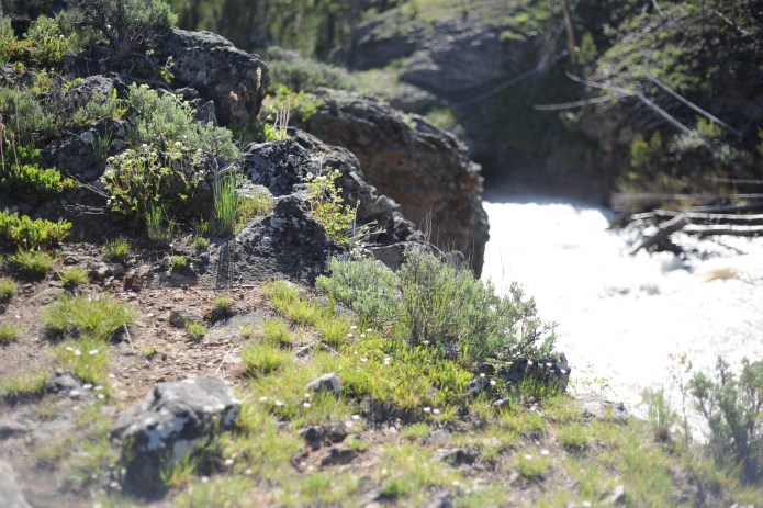
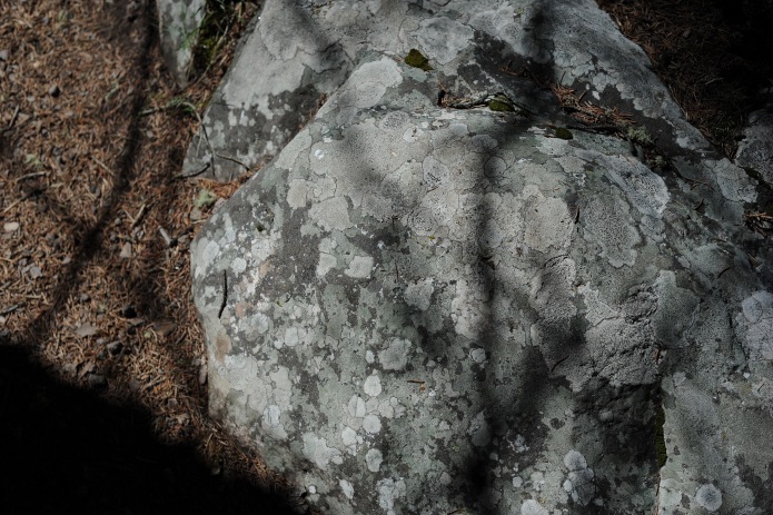
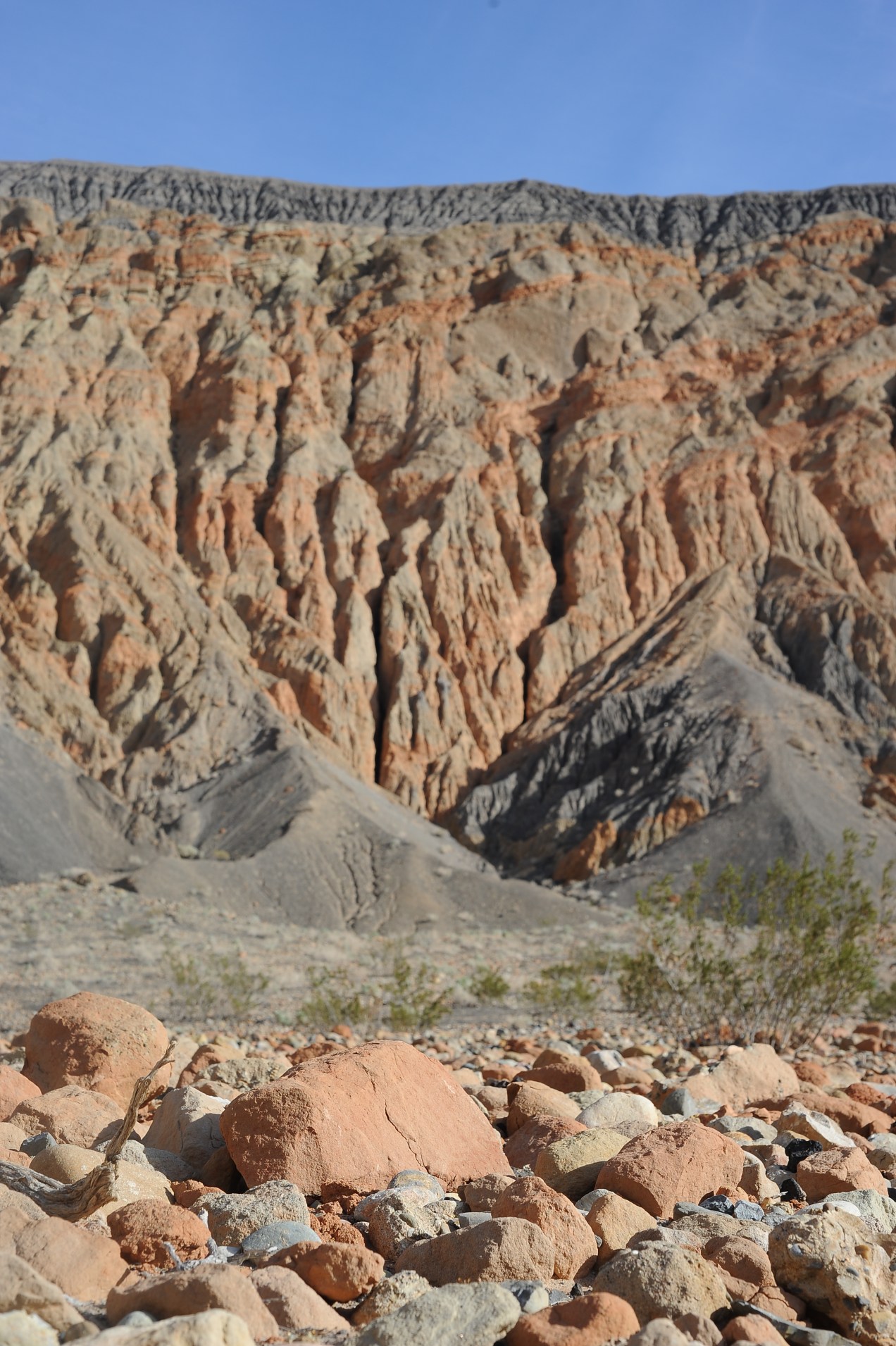
Aside from the wonderful array of flowers, the rocks were just as fascinating to me.

Seeing life spring from the cracks between these rocks made me appreciate the tenacity of life in the desert.

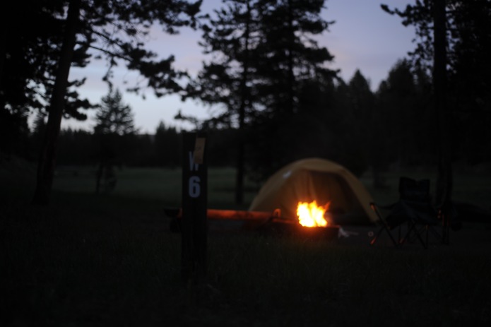
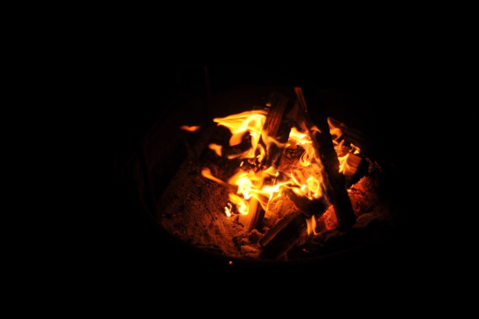
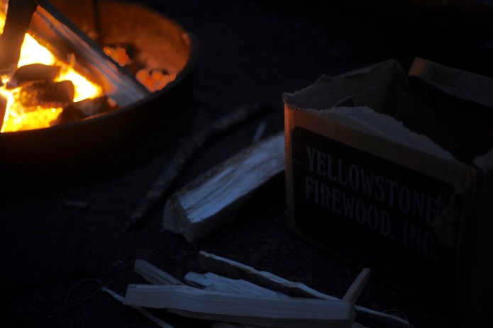
After the sun came up and turned the flowers and mountains to gold, we backtracked to Stovepipe Wells to set up our camp and sleep the hottest part of the day away . . .

. . . or, so we thought.

To read more about our Death Valley adventures, stay tuned for more blog posts and read:


Death Valley Birthday

Standard